Monday, July 21, 2008

Sandias At Last


The monsoons rains have been soaking the mountains.  The Forest Service has lifted their closures.  The pics say it all.  The parched high country has come alive!  

These pics were snapped on a loop from Canyon Estates, along the Lower Fawlty Trail through the dense woods on the east side of the Sandias, up to the Crest on Bart's Trail, then south along the Crest Trail to point of beginning.  About 16 miles, by a wild guess.  I saw only three people the entire day.  Go figure.  

Tuesday, July 8, 2008

My Hike in the Sandias...Not!


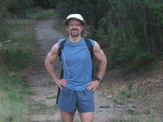
Pack waiting by the door ready to go.  The coolness of the early morning an hour before sunrise. I'm heading out for my first hike since my auto accident in Mexico (previous post).  I'm anxious, a bit nervous about going for a 20 miler in the Sandias on legs that haven't covered a trail of any sort in four months.  

And then I remembered.  

Dang!  #@%$#%$#)!!!!&(*&&%&%!!!!

The Sandias are still closed on account of fire danger and stupid people.  

So instead of shots of South Sandia Peak and the meadows at Deer Park, I can offer only this pic of my Jamis road bike.  I switched out my Vasque trail shoes for my Sidi racing shoes, my indestructible, twenty-year old Sportif canvas shorts for my padded Louis Garneau bike shorts. My Eclipse and I did sixty plus miles, including a climb from the Rio Grande to the bottom of the Tram.  I'm guessing at least a 2,000 foot climb in elevation.  It felt good.

A great ride.  I think my stamina is back.  But, nonetheless, it wasn't the plan.

I learned from the Tram ticket taker that the night before some guy had sneaked into the Sandia Wilderness.  I've never seen a backcountry ranger in those mountains, so the chances of apprehension are minimal.  Unless you suffer a heart attack and call for help on your cell phone.  After the helicopter pulled him off the mountain, as he was in the ambulance heading for the hospital, the rangers handed him a citation.  He'll get a bill for the rescue when they add the numbers. 

Biking's great.  But I want to hike the mountains out my back door!  So come on rain!  Freshen the high country, sprinkle your blessings on our Sandias, and may the yellow USFS tape across the trail be gone!

Sunday, July 6, 2008

After the Accident, Back in Action

This blog has been dead since February.  That's because in early March I was in a car accident just north of San Miguel de Allende, Mexico.  We were T-boned.  I saw it coming and had two thoughts:  1) we were all going to die and 2) if we don't, what a nightmare it will be dealing with the Mexican legal system.  We survived, all of us.  We did have to pay a bribe demanded by the Federale.  That's all I ever want to see of the Mexican legal system.

God bless the safety engineers at Honda.  The Chrysler that hit us broadside was totaled.  My wife was bruised on the side where she was knocked into me.  Otherwise, not a scratch.  I got the worst of anyone in the CRV.  I suffered a concussion and awful whiplash.  The concussion cleared after 48 hours.  The whiplash has taken three months to resolve itself, and it's still nagging me, sometimes freezing up my entire left side.  But I'm pushing through it every week, getting better with every run and work out. 

I'm recovered enough to take up hiking and biking again.  I did the Tour de Bosque 50 mile bike ride to raise funds for AIDS research two weeks ago.  Tomorrow I am heading into the Sandias to see if I have the stamina for a long hike in the Summer heat.  I'm sure I'll be fine.  I hope to have photos to prove it. 

Tuesday, February 19, 2008

San Lorenzo Canyon

Kara and I spent the federal holiday traipsing around San Lorenzo Canyon.  This is BLM recreation site reached from the I-25 Lemitar exit.  You go about five miles north on the western frontage road until you reach a tee where the roadway turns to dirt.  Take the left fork and head west, paralleling the border to the Sevilleta Wildlife refuge.  There is one sign and one arrow along the way to steer you right. This view shows the canyon looking east across the Rio Grande to the start of Chupadera Mesa.  That is Sepultura Canyon in the shadows on the western slope, where mexican gray wolves have been kept before release in the Gila.


Unlike the arroyos in the Quebradas on the east side of the Rio Grande, San Lorenzo Canyon was cut from only sandstone.  The bottom is very sandy and passable by motor vehicle.  We tried biking this day, but the sandy bottom made movement extremely difficult.  So we ditched the mountain bikes and hoofed it.  The BLM land dead ends at a basaltic/granite rock dam across the canyon that marks the start of the Sevilleta refuge, where human wanderers are not permitted, on foot or wheel.


Friday, February 8, 2008

Steve Ilg

I owe my stamina and injury-free history of outdoor activities to this guy.  I picked up his book "The Outdoor Athlete" fifteen years ago.  Its training regimen helped me manage a hike from Kingston to Glenwood, across the Aldo Leopold and Gila Wildernesses, five mountain ranges, river fords, and snow storms, averaging over 26 miles a day with a full load.  Or my birthday hikes taking in the full length of either the Sandia or Manzano ranges in time to get home for a great celebratory meal before sundwon.  

"The Outdoor Athlete" offers suggested training routines for every activity, from mountain biking to kayaking.  I have particularly benefitted from his "2-WayIlgs" and adaptation of some ballet moves, with weight added for building strength.  I heartily recommend Steve Ilg as a model and teacher to anyone who finds spiritual rewards in the challenges of strenuous outdoor athletics, and who wants to keep at it their whole life.   Check him out for yourself.

Wednesday, February 6, 2008

Hiking the Organ Mountains


I was in Las Cruces to meet with the people promoting a plan to preserve over 300,000 acres of Dona Ana County as open space and rangeland.  The proposal started with ranchers but has now gained the support of some 600 businesses, organizations and respected professionals, like the past presidents of New Mexico State University.  I came away impressed with the ranchers behind this effort and the integrity of their proposal.
The next morning I got up early to climb the Organ Needle.  But federal employees sleep later than I and the gate to the trailhead at the Dripping Springs visitor center was locked before dawn. So I turned south on Baylor Canyon road and drove to the trailhead for Baylor Canyon Pass.
Every year trail runners race this trail to Aguirre Springs on the back side of the Organs, facing White Sands Missile Range.  It's a good trail, but I had a fifty mile an hour wind for company up in the pass.  It spun me around and the cold wind pierced my clothes and froze my face. 
But I had the Organ Mountains to myself this day, beautiful nonetheless.  The fierce wind was just part of the experience. 
It is 6 miles each way to Aguirre Spring.  This hike makes a good introduction to the Organ Mountains.